Quick Facts
- Distance: 42.4 miles point-to-point.
- Difficulty: Moderate with significant sandy terrain and rolling elevation.
- Permits: Mandatory year-round via Recreation.gov; reserve 6 months in advance.
- Shuttle: Altran (Alger County Transit) or private service required for linear route.
- Best Time: July and August for manageable insects and warm water.
- Key Regulation: Hard-sided bear canisters are not required, but bear-resistant food lockers are mandatory and provided.
Backpacking at Pictured Rocks National Lakeshore requires a backcountry camping permit for all overnight stays. Permits must be reserved in advance through Recreation.gov and users must strictly adhere to their designated itinerary. In addition to the camping permit, hikers must also possess a valid National Park Pass or pay the park entrance fee at a visitor center. This ensures your Pictured Rocks backpacking adventure remains organized within the delicate ecosystems of the Upper Peninsula wilderness.
Mastering the Logistics: Permits and Shuttles
Setting foot on the Lakeshore Trail requires precision planning long before you reach the Upper Peninsula. Your Pictured Rocks backpacking trip begins exactly six months before your start date. That is when the booking window opens on Recreation.gov, and for popular months like July and August, sites disappear within minutes. Expect to pay a $15 non-refundable reservation fee along with $5 per person, per night.
Logistics coordination isn't just about where you sleep; it is about how you get back to your car. The trail is a linear path along the Lake Superior shoreline, connecting Munising and Grand Marais. Most hikers find the most efficient method is to park their vehicle at their planned finish line and catch the Altran shuttle to their starting point.
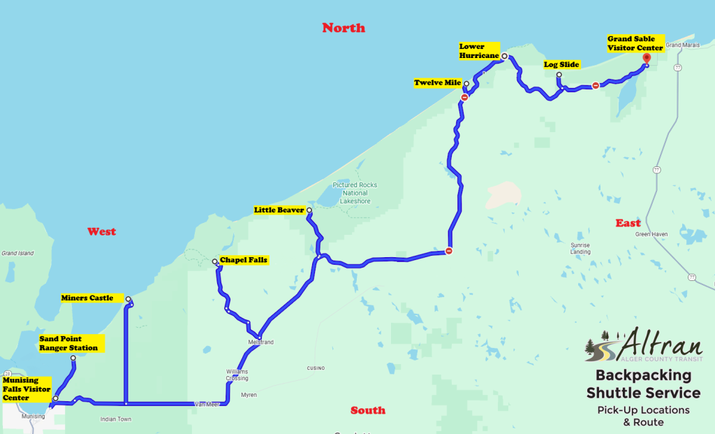
Knowing how to use the Pictured Rocks hiking shuttle is the difference between a smooth trek and a stressful hitchhike. Managed by Alger County Transit, the backpacker shuttle costs $40 and requires a reservation at least one week in advance. They are strict about timing and pick-up locations. If you miss your window, your other option is Paddling Michigan, which offers more on-demand flexibility but at a higher price point. Always carry a hard copy of your Pictured Rocks backcountry camping permit guide and your transit reservation, as cell service is nearly non-existent once you leave the gateway towns.
Pro Tip: If you are traveling as a group, have one person handle the Recreation.gov login to secure the entire itinerary at once. Splitting the reservation across multiple accounts often results in one person getting the site and the other being left out.
Route Strategy: Westbound vs. Eastbound
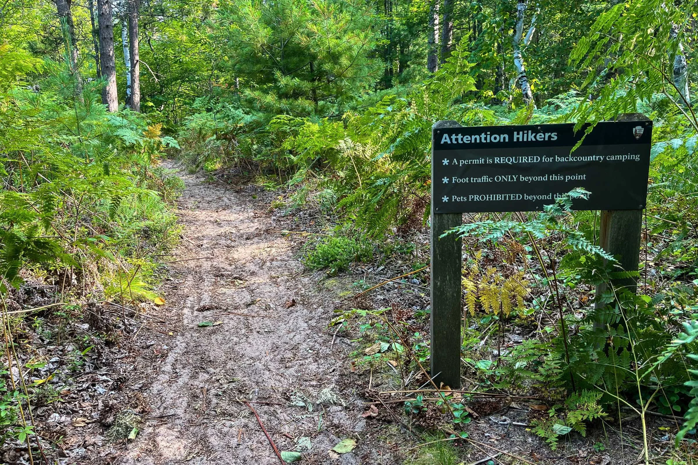
When deciding your Pictured Rocks backpacking itinerary 4 days in length, you must choose a direction. While the trail can be hiked in either direction, most veterans recommend traveling westbound—starting at the Grand Sable Visitor Center near Grand Marais and finishing at Munising Falls.
This direction provides a psychological and visual crescendo. You begin with the massive Grand Sable Dunes, where the scale of the landscape is immense but the vegetation is sparse. As you move west, the terrain transitions into the dense hardwoods of the Beaver Basin Wilderness Area and culminates with the world-famous Sandstone cliff formations. Ending near Munising also places you closer to post-hike amenities like a hot shower and a local Pasty.
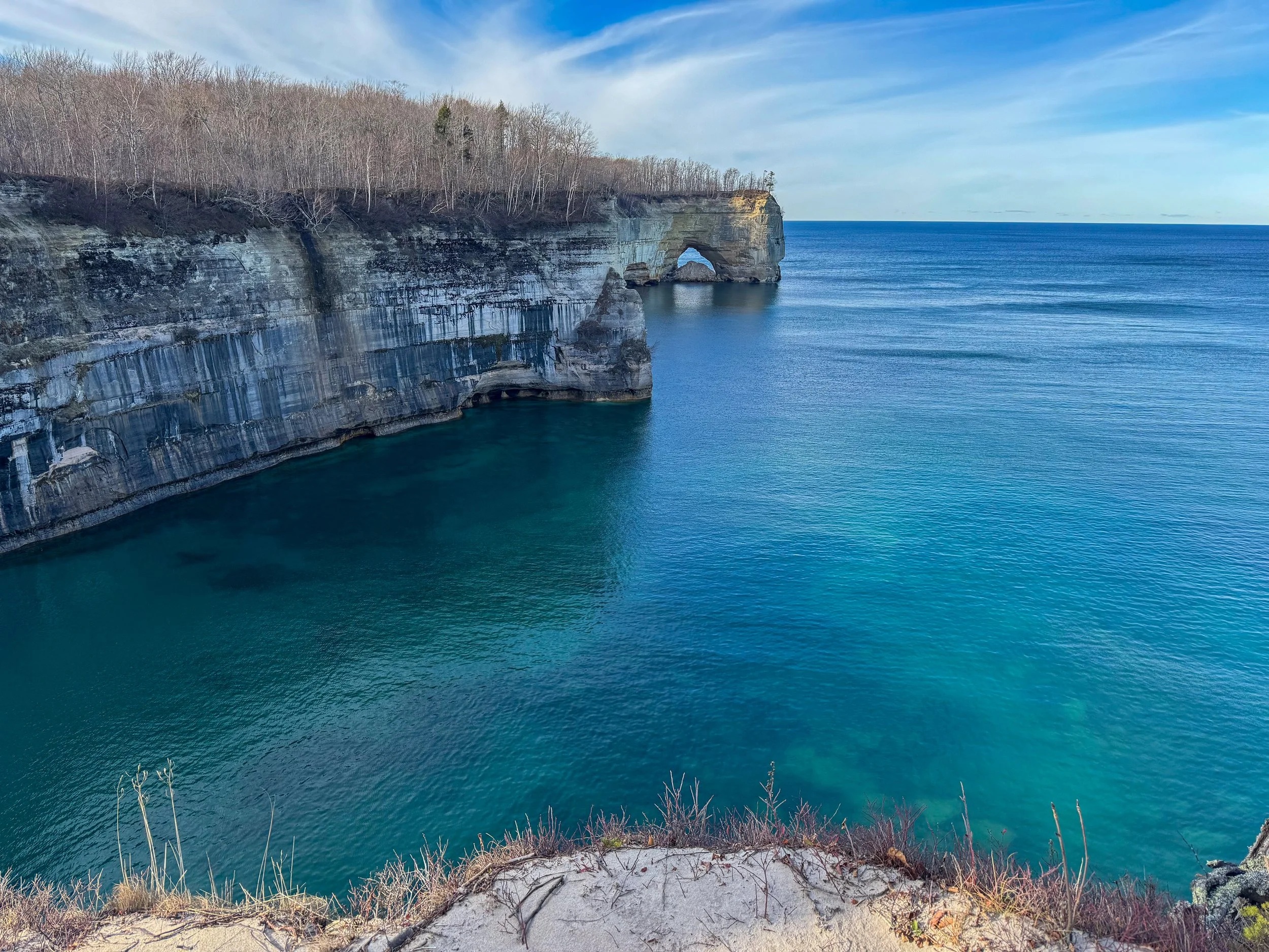
A standard Pictured Rocks backpacking itinerary covers four to five days, averaging 8 to 11 miles daily. A typical four-day westbound route might look like this:
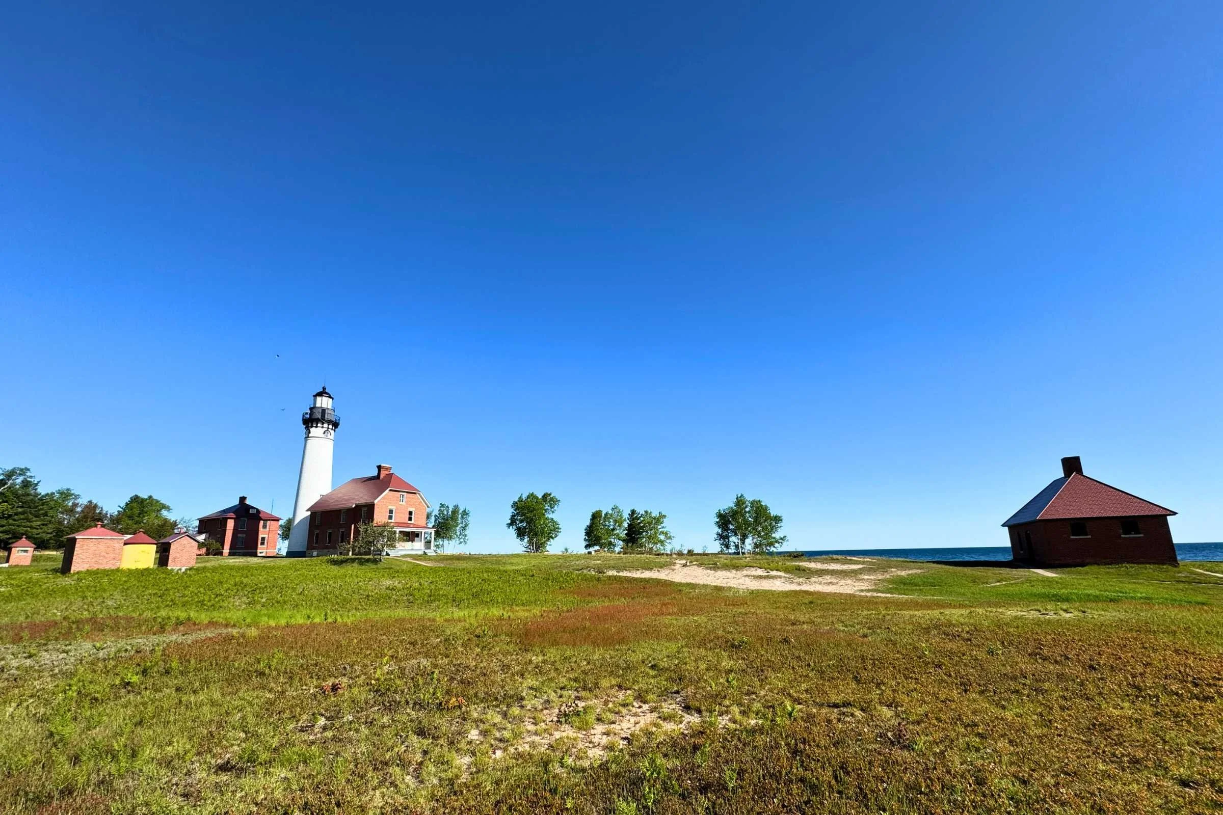
- Day 1: Grand Sable to Au Sable East (8.5 miles). Explore the Au Sable Point Lighthouse.
- Day 2: Au Sable East to Trappers Lake (11.5 miles). Traditional deep woods camping.
- Day 3: Trappers Lake to Mosquito River (10.5 miles). The highlight day featuring Grand Portal Point.
- Day 4: Mosquito River to Munising Falls (9.4 miles). A forest-heavy finish with cliff-top views.
Campsite Cheat Sheet & Critical Water Gaps
The Lakeshore Trail features 14 designated backcountry campgrounds for hikers that are typically spaced at intervals of 2 to 5 miles along the 42.4-mile Lakeshore Trail. Each site offers a unique experience, from the high bluffs of the Cliffs campsite to the beachside lullaby of Twelvemile Beach.
| Campground | Miles from Munising | Water Access | Toilet Type |
|---|---|---|---|
| Cliffs | 6.8 | Lake Superior (Difficult Access) | Vault |
| Mosquito River | 9.4 | River & Lake Superior | Vault |
| Chapel Beach | 12.2 | Creek & Lake Superior | Vault |
| Potato Patch | 14.9 | None (Dry Site) | Vault |
| Beaver Creek | 18.6 | Creek & Lake Superior | Vault |
| Trappers Lake | 20.8 | Inland Lake | Vault |
| Sevenmile Creek | 23.9 | Creek & Lake Superior | Vault |
| Benchmark | 27.2 | Lake Superior | Vault |
| Au Sable East | 35.4 | Lake Superior | Vault |
One of the most important tactical considerations is managing water. While you are hiking next to the largest freshwater lake on earth, the cliffs often sit 200 feet above the water. Between Twelvemile Beach and Miner’s Castle, there is a significant water gap where finding a safe path down to the Lake Superior shoreline is nearly impossible. Fill your bladders completely before leaving Sevenmile Creek or Chapel Beach.
Furthermore, sites like Potato Patch and Cliffs are considered "dry" or high-elevation sites. This means you must haul all the water you need for dinner and the next morning's breakfast uphill to your camp.
Tactical Gear: Sand, Bugs, and Bears
Your standard backpacking kit needs three specific adjustments for the Upper Peninsula. First, the Biting stable flies. These are not your average houseflies; they are relentless, and they are largely immune to DEET or Picaridin. They focus on ankles and calves. The only real defense is physical: wear long pants and carry a head net for when the wind dies down.
Second, the sand. The trail oscillates between soft dune sand and hard-packed forest floor. Sand in your boots leads to hotspots and blisters within miles. Lightweight trail gaiters are highly recommended to keep the grit out of your socks.
Finally, while this isn't grizzly country, we take Black bear safety protocols seriously here. Every designated backcountry site is equipped with a bear-resistant food locker. You are required to store all scented items—food, trash, toothpaste, and even sunscreen—inside these lockers. Because of this infrastructure, you do not need to carry a heavy bear canister, saving you significant pack weight.
For water treatment, ensure your filter is rated for Giardia and Cryptosporidium. While Lake Superior looks pristine, the runoff from inland creeks requires a reliable 1-micron filtration system.
Local Insight: If you're hiking in June, the black flies can be "biblical." Moving your trip to the best time to backpack Pictured Rocks Lakeshore Trail—usually late July through September—will make for a much more pleasant experience with fewer blood-sucking hitchhikers.
Beyond the Trail: Munising Culture & Side Quests
The 42.4-mile main line is spectacular, but the "side quests" define the trip. Pictured Rocks backpacking is better when you take the time to explore. Don't skip the short spur to the Au Sable Point Lighthouse, where you can see the remains of 19th-century shipwrecks embedded in the shoreline sand.
Near the western end, the trail passes the Chapel Rock natural arch and the majestic Spray Falls, which plunges directly into Lake Superior. These spots are popular with day hikers, so expect more crowds, but the geology is undeniable.
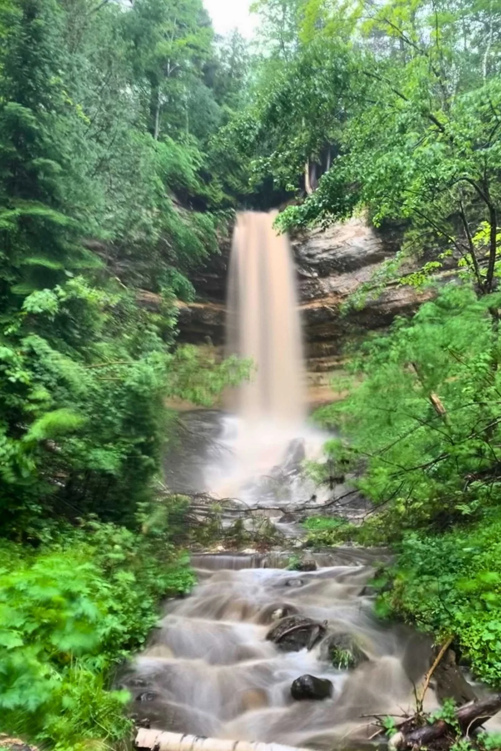
Once you emerge at Munising Falls and complete your journey, it is time for the local rites of passage. Follow the Leave No Trace ethics all the way to the trash can at the trailhead, then head into town. No trip to the Upper Peninsula is complete without sampling the local Munising flavor.
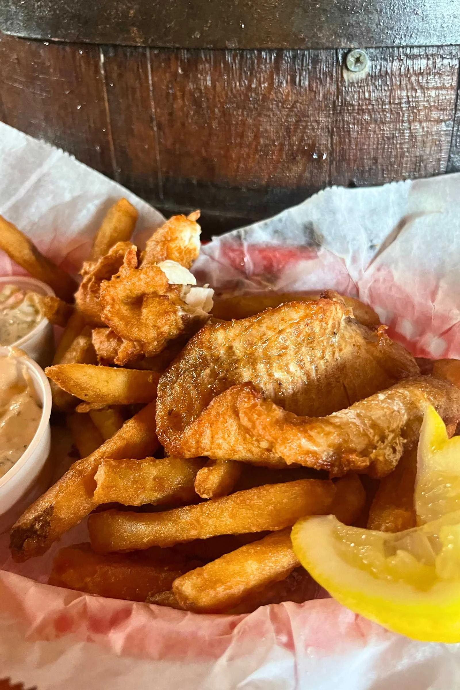
Stop at a local bakery for a traditional UP Pasty—a meat and veggie hand pie that was the staple of iron miners. For dinner, look for a spot serving fresh Lake Superior Whitefish. It is the cleanest, mildest fish you will ever eat, usually caught the same morning.
FAQ
Do you need a permit to backpack Pictured Rocks?
Yes, a backcountry camping permit is mandatory for all overnight stays within Pictured Rocks National Lakeshore. These must be reserved via Recreation.gov. You cannot self-issue these at the trailhead, and they often sell out six months in advance. You also need a separate park entrance pass for your vehicle or person.
How many days does it take to hike the Pictured Rocks trail?
Most hikers complete the 42.4-mile Lakeshore Trail in four to five days. This allows for a moderate pace of 8 to 11 miles per day, providing ample time to explore lighthouses, shipwrecks, and beach sections without rushing to reach camp before dark.
What is the best time of year to backpack Pictured Rocks?
The best time of year to backpack Pictured Rocks is from late July through September. By late July, the notorious black fly and mosquito populations begin to dwindle, and the Lake Superior water temperatures reach their peak, making post-hike swims much more bearable. September offers cooler hiking temperatures and stunning fall foliage.
Are there bears in Pictured Rocks National Lakeshore?
Yes, Pictured Rocks is home to a healthy population of black bears. While they are generally shy, they are attracted to human food. The park provides bear-resistant food lockers at every backcountry campsite. Use them for all "smellables" and never keep food inside your tent to ensure a safe encounter for both you and the bears.
How do you get a shuttle for Pictured Rocks backpacking?
The primary shuttle service is Altran (Alger County Transit), which runs a specific backpacker route between Munising and Grand Marais. You must book your seat at least one week in advance. Another option is using Paddling Michigan’s shuttle service, which offers more frequent departures for a higher fee. It is best to park at your finish point and shuttle to your start.